
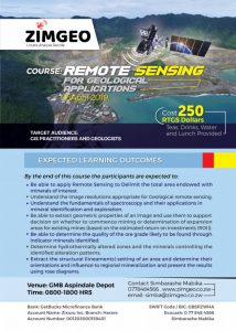
Expected Learning outcomes
By the end of this course the participants are expected to:
- Appreciate the value of remote sensing in mining organizations
- Be able to apply Remote Sensing to Delimit the total area endowed with minerals of interest
- Understand the image resolutions appropriate for Geological remote sensing
- Understand the fundamentals of spectroscopy and their applications in mineral identification and exploration
- Be able to extract geometric properties of an image and use them to support decision on whether to commence mining or determination of expansion areas for existing mines (based on the estimated return on investments (ROI))
- Be able to determine the quality of the ore grade likely to be found through indicator minerals identified
- Determine hydrothermally altered zones and the minerals controlling the identified alteration patterns
- Extract the structural (lineaments) setting of an area and determine their orientations and influence to regional mineralization and present the results using rose diagrams
Assumed knowledge
Basic digital literacy is needed to complete the practicals
Requirements of the course
Dual core laptops or desktop computers
Internet connection to download satellite images
GIS software’s
Nb: Some open software’s will be provided together with this tutorial
| Contents | |
| Part I: Fundamentals of Remote Sensing
1. Remote Sensing Overview 1.1 Definition 1.2 Remote Sensing Concept 1.3 Components in Remote Sensing 1.4 Types of Remote Sensing 1.5 Multistage Remote Sensing Data Collection 1.7 Types and Uses of Satellites
|
4. Spectroscopy ( Hyper-spectral remote sensing)
4.1 Fundamentals of spectroscopy 4.2 Sources of spectroscopic data 4.3 Hyper-spectral image analysis
|
| 2. Remote Sensing Data Acquisition
2.1 Electromagnetic Waves Used in Remote Sensing 2.2 Properties of Electromagnetic Waves 2.3 Spectral Reflectance and Earth Surface Interaction 2.4 Multi-spectral Remote Sensing Data (Image) 2.5 Spectral Properties and Principal Applications 2.6 Spectral Reflectance to DN (Digital Number) 2.7 Structure of Remote Sensing Data 2.8 Resolutions in Remote Sensing
|
5. Remote Sensing Data for Geological applications
5.1 Land Cover Classification 5.2 Hydrothermal alteration mapping 5.3 Lineament detection 5.4 Gravity anomaly mapping 5.5 Magnetic anomaly mapping 5.6 Mineral Spectral signature identification 5.7 Geological surveying 5.8 Mineral abundance mapping 5.9 Hydrogeological mapping
|
| 3. Remote Sensing Data Processing and Analysis
3.1 Remote Sensing Data Pre-processing 3.2 Visual Interpretation (Band combination) 3.3 Apply Algorithms 3.4 Multi-spectral Classification 3.5 Digital Elevation Model (DEM) processing Catchment extraction Drainage network extraction |
6. Practical applications of RS in Agricultural applications
6.1 Digital image processing (Sentinel 2 and landsat8) 6.2 Image classification 6.3 Spectral resampling for sentinel 2 MSI 6.4 NDVI calculations 6.5 Above ground biomass calculation 6.6 Extracting spectral properties of an image 6.7 Hydrothermal alteration mapping using mineral indices and band ratios 6.8 Lineament extraction from images 6.9 Practical Examples Lithium and Gold
|
| 7. Image filtering techniques
7.1 Edge detection and enhancement 7.2 Directional filters
|
|
Software’s
Integrated Land and Water Information System (ILWIS)
Quantum Geographic Information System (QGIS)
Snap
Sen2core
Nb: All these are open source software ie they are distributed for free
Datasets
Landsat 8 Operational Land imager
Sentinel 2 satellite image
Suggested Reading materials
ISRS Proceeding Papers of Sort Interactive Session ISPRS TC VIII International Symposium on “Operational Remote Sensing Applications: Opportunities, Progress and Challenges”, Hyderabad, India, December 9 – 12, 2014

Expected Learning outcomes
By the end of this course the participants are expected to:
- Appreciate the value of remote sensing in insurance Organizations
- Be able to apply Remote Sensing to Delimit the total area cropped by a farmer
- Understand the image resolutions appropriate for Agricultural remote sensing
- Understand the fundamentals of spectroscopy and their applications in land auditing
- Be able to extract geometric properties of an image and use them to validate insurance claims made by clients
- Monitor compliance i.e. irrigation and fertilization of crops
- Be able to extract the total area lost to (pest infestations, drought, fire among others)
| Contents | |
| Part I: Fundamentals of Remote Sensing
1. Remote Sensing Overview 1.1 Definition 1.2 Remote Sensing Concept 1.3 Components in Remote Sensing 1.4 Types of Remote Sensing 1.5 Multistage Remote Sensing Data Collection 1.7 Types and Uses of Satellites
|
4. Spectroscopy ( Hyper-spectral remote sensing)
4.1 Fundamentals of spectroscopy 4.2 Sources of spectroscopic data 4.3 Hyper-spectral image analysis
|
| 2. Remote Sensing Data Acquisition
2.1 Electromagnetic Waves Used in Remote Sensing 2.2 Properties of Electromagnetic Waves 2.3 Spectral Reflectance and Earth Surface Interaction 2.4 Multi-spectral Remote Sensing Data (Image) 2.5 Spectral Properties and Principal Applications 2.6 Spectral Reflectance to DN (Digital Number) 2.7 Structure of Remote Sensing Data 2.8 Resolutions in Remote Sensing
|
5. Remote Sensing Data for Agricultural applications
5.1 Land Cover Classification 5.2 Vegetation monitoring 5.3 Crop condition assessment 5.4 Crop identification 5.5 Soil moisture mapping 5.6 Burnt area mapping 5.7 property, boundary and cropped area delineation 5.8 Land and Environmental auditing 5.9 Vegetation stress monitoring using red edge shifts
|
| 3. Remote Sensing Data Processing and Analysis
3.1 Remote Sensing Data Pre-processing 3.2 Visual Interpretation (Band combination) 3.3 Apply Algorithms 3.4 Multi-spectral Classification |
6. Practical applications of RS in Agricultural applications
6.1 Digital image processing (Sentinel 2 and landsat8) 6.2 Image classification 6.3 Spectral resampling for sentinel 2 MSI 6.4 NDVI calculations 6.5 Above ground biomass calculation 6.6 Extracting spectral properties of an image |
Assumed knowledge
Basic digital literacy is needed to complete the practicals
Requirements of the course
Dual core laptops or desktop computers
Internet connection to download satellite images
GIS software’s
Nb: Some open software’s will be provided together with this tutorial
Software’s
Integrated Land and Water Information System (ILWIS)
Quantum Geographic Information System (QGIS)
Snap
Sen2core
Nb: All these are open source software i.e. they are distributed for free
Datasets
Landsat 8 Operational Land imager
Sentinel 2 satellite image
Suggested Reading materials
ISRS Proceeding Papers of Sort Interactive Session ISPRS TC VIII International Symposium on “Operational Remote Sensing Applications: Opportunities, Progress and Challenges”, Hyderabad, India, December 9 – 12, 2014
Course Outline and Objectives :
Aims :
The course will introduce the main concepts in GIS and Remote Sensing. The introductory part gives a theoretical and practical grounding into aspects of Geographic Information systems and Remote Sensing. The course will be a combination of theory and practicals.
The outcomes
By the end of the conference students should be able to:
• Define and appreciate the utility of Geographic Information Systems (GIS)
• Describe the various key concepts undertaken under Geographic Information systems.
• Use GIS software to map different phenomena
• Acquire different data sets using remote sensing (data collection)
• Appreciate the methods of data collection in the field
• Perform Data analysis and mapping in a GIS
Assumed knowledge
Basic digital literacy is needed to complete the practicals
Requirements of the course
• Dual core laptops or desktop computers
• Internet connection to download satellite images
• GIS software’s
Nb: Some open software’s will be provided together with this tutorial
Course Outline :
• Principles of Geographic Information Systems and Remote Sensing Overview
• Remote Sensing Concept
• Components in Remote Sensing
• Types of Remote Sensing
• Coordinate Systems and Map Projections
• The Global Positioning Systems (GPS) for data collection
• Principles of Geo-referencing and Methods of digitizing data.
• Map Design
• Types and Uses of Satellites
• Spatial Analysis in a GIS

1. Zimgeo GIS & Remote Sensing Bootcamp (March to April 2023)
The bootcamp comprises of 2 broad categories for the GIS and Remote Sensing Training. The first category is on Introduction to GIS and Remote Sensing and the second category is on the application of GIS and Remote Sensing in various fields (agriculture, telecommunications, disaster risk reduction, mining and forestry)
1.1. The Introduction to GIS and Remote Sensing is divided further into 4 sub-categories and participants are free to choose to take any or all of the sub-categories.
1.1.1. Aims
The first category will introduce the main concepts in GIS and remote sensing. The introductory part gives a theoretical and practical grounding into aspects Geographic Information systems and remote sensing.
1.1.2. The outcomes
By the end of the conference students should be able to:
• Define Geographic Information System (GIS)
• Appreciate the role of remote sensing in earth observation and to access the different sources of remotely sensed data
• Describe the various key concepts undertaken under Geographic Information systems.
• Analyse spatial Data
• Use GIS software to map different phenomena
1.1.3. Methods of Instruction
Formal presentation of theoretical material will be presented via a lecture.
A Practical will follow after the main theoretical concepts.
1.1.4. Costing
Each sub-category under Introduction to GIS and Remote Sensing is priced at USD$80 or ZWL$56 000. A certificate of completion is given when a student does and completes all the 4 sub-categories at a promotional cost of USD$280 or ZWL$196 000 for all the 4 sub-categories. For corporate clients a Purchase Order (PO) will suffice.
1.1.5. Curriculum :
a) Introduction to GIS : Week 1 Saturday 4 March
• What is GIS?
• GIS data types and sources of Geographic Data (vector and raster)
• Coordinate systems (geographic and projected)
• Georeferencing and Digitising
• Introduction to spatial data processing tools in QGIS
b) Introduction to Remote Sensing : Week 1 Saturday 5 March
• What is Remote Sensing?
• Active and Passive Satellites
• Satellite images and their characteristics
• Image preprocessing and processing
• Spectral indices
c) Spatial Data analysis in a GIS : Week 2 Saturday 11 March
• Point data analysis
• Line data analysis
• Basics of Satellite Image Classification
• Polygon data analysis raster data analysis
d) Map design and data presentation : Week 2 Saturday 12 March
• Create a GIS map in QGIS
• Add the basic map elements to a map layout (title, scale, north arrow, descriptive text)
• Adding the advanced map elements (map grid and overview map) in QGIS
• Creating charts from spatial data
• Formatting and analysing GIS charts
1.2. The application of GIS and Remote Sensing in various fields (agriculture, telecommunications, disaster risk reduction, forestry and mining) is divided into 5 sub-categories and participants are free to choose to take any or all of the sub-categories.
1.2.1. Aims
The second category will introduce participants to the different techniques and methodologies from GIS and Remote Sensing into various application areas mainly (agriculture, disaster risk reduction (DRR), telecommunications, mining and forestry)
1.2.2. Methods of Instruction
Formal presentation of theoretical material will be presented via a lecture.
A Practical will follow after the main theoretical concepts.
1.2.3. Costing
Each sub-category under Introduction to GIS and Remote Sensing is priced at USD$300 or ZWL$210 000. A certificate of completion is given after each sub-category. For corporate clients a Purchase Order (PO) will suffice.
1.2.4. Curriculum :
a) GIS and Remote Sensing Applications in Agriculture : Week 3 Saturday 18 and Sunday 19 March
• Spectral indices and the biophysical parameters retrieved from images
• Computation of the vegetation index
• Basics of Satellite Image Classification
• Accuracy Assessment of LULC a map
• Land cover assessment
• Basics of change detection – image differencing
b) GIS and Remote Sensing applications in Disaster Risk Reduction : Week 4 Saturday and Sunday ( 25 and 26 March)
• DEM processing in a GIS
• Drought hazard mapping in a GIS
• Basics of change detection – image differencing for flood mapping
c) GIS and Remote Sensing applications in Telecommunications: Week 5 Saturday and Sunday (1 and 2 April)
• Telecommunication infrastructure mapping
• Introduction to Geodatabases
• Web-GIS for infrastructure management
• Base station siting suitability using AHP and multi-criteria analysis
d) GIS and Remote Sensing Applications in forest management: Week 6 Saturday and Sunday (8 and 9 April)
• Computation of the vegetation index
• Basics of Satellite Image Classification
• Accuracy Assessment of LULC a map
• Land cover assessment
• Basics of change detection – image differencing
e) GIS and Remote Sensing Applications in mining: Week 6 Saturday and Sunday (15 and 16 April)
• Vector data for mapping mine titles,
• Kriging in QGIS,
• Geological maps georeferencing and
• Accessing mine data from USGS
1.3. Assumed knowledge
Basic digital literacy is needed to complete the practicals
Requirements of the course
• • Dual core laptops or desktop computers
• • Internet connection to download satellite images
• • GIS software’s
Nb: Some open software’s will be provided together with this tutorial
1.4. Payments
Payment can be done in cash, or by depositing into our bank accounts using the details below. Please note the pricing includes refreshments and lunch meal. Cash payments can be done at our offices: 12th Floor Joina City, Harare, Zimbabwe. For corporate clients a Purchase Order (PO) will suffice.
Course Description Price(USD$) Price (ZWL$) Day ( 9 AM – 4 PM) 2023
Introduction to GIS and Remote Sensing
Introduction to GIS USD$80 ZWL$56 000 Week 1 Saturday 4 March
Introduction to Remote Sensing USD$80 ZWL$56 000 Week 1 Sunday 5 March
Spatial Data analysis in a GIS USD$80 ZWL$56 000 Week 2 Saturday 11 March
Map design and data presentation USD$80 ZWL$56 000 Week 2 Saturday12 March
Introduction to GIS and Remote Sensing once off for all 4 modules USD$280 ZWL$196 000 Week 1 – 2
GIS and Remote Sensing Applications in Agriculture USD$300 ZWL$210 000 Week 3 Saturday and Sunday ( 18 and 19 March
GIS and Remote Sensing applications in Disaster Risk Reduction : USD$300 ZWL$210 000 Week 4 Saturday and Sunday ( 25 and 26 March)
GIS and Remote Sensing applications in Telecommunications USD$300 ZWL$210 000 Week 5 Saturday and Sunday (1 and 2 April)
GIS and Remote Sensing Applications in forest management USD$300 ZWL$210 000 Week 6 Saturday and Sunday (8 and 9 April)
GIS and Remote Sensing Applications in mining: USD$300 ZWL$210 000 Week 6 Saturday and Sunday (15 and 16 April)
1.4.1. Bank details
(NOSTRO Banking details)
Bank: CABS
Account name: Map Tech Pvt Ltd t/a Zimgeo
Account number: 1130216675
Branch: Borrowdale
(RTGS banking details)
Bank: CABS
Account name: Map Tech Pvt Ltd t/a Zimgeo
Account number: 1130216608
Branch: Borrowdale
1.5. Venue
Rokpa Centre
34 Qundon Rd, Monavile, Harare
1.6. Contact us,
For more information,
Call : +263 719 751 574
Email : info@zimgeo.co.zw
www.zimgeo.co.zw