
INTRODUCTION TO GIS AND REMOTE SENSING (JANUARY 2021)

Remote Sensing for land and agricultural applications Course
February 16, 2019
INTRODUCTION TO GIS AND REMOTE SENSING (MARCH 2021)
February 9, 2021
Course Outline and Objectives :
Aims :
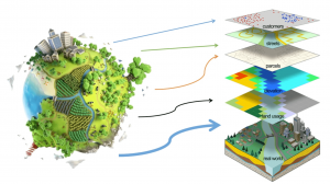
The course will introduce the main concepts in GIS and Remote Sensing. The introductory part gives a theoretical and practical grounding into aspects of Geographic Information systems and Remote Sensing. The course will be a combination of theory and practicals.
The outcomes
By the end of the conference students should be able to:
• Define and appreciate the utility of Geographic Information Systems (GIS)
• Describe the various key concepts undertaken under Geographic Information systems.
• Use GIS software to map different phenomena
• Acquire different data sets using remote sensing (data collection)
• Appreciate the methods of data collection in the field
• Perform Data analysis and mapping in a GIS
Assumed knowledge
Basic digital literacy is needed to complete the practicals
Requirements of the course
• Dual core laptops or desktop computers
• Internet connection to download satellite images
• GIS software’s
Nb: Some open software’s will be provided together with this tutorial
Course Outline :
• Principles of Geographic Information Systems and Remote Sensing Overview
• Remote Sensing Concept
• Components in Remote Sensing
• Types of Remote Sensing
• Coordinate Systems and Map Projections
• The Global Positioning Systems (GPS) for data collection
• Principles of Geo-referencing and Methods of digitizing data.
• Map Design
• Types and Uses of Satellites
• Spatial Analysis in a GIS